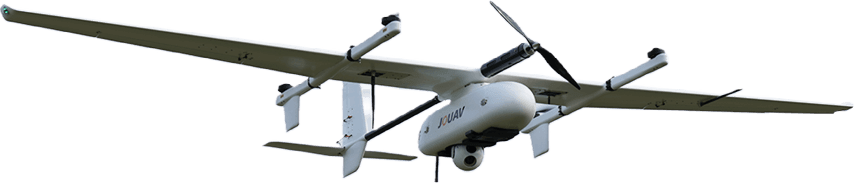
CW-15
VTOL platform under program
Multi-purpose intelligent VTOL drone. New-generation flight safety, avionics, and Andean high-altitude performance — the DAI standard for mining corridors.
Learn MoreChapter 04 of DAI: OEM VTOL platforms and mission sensors under DAI contract — most can be assembled in Peru. Intelligence lives in ORBIT BRIDGE and DAI-ATLAS, not in gadget sales.
Peru ProgramCHAPTER 04 · FIELD ASSETS
Most platforms listed here can be built and fielded in Peru under contract with DAI (OEM 50/50, 3–5 months). They are authorized collection means under DAI-ATLAS; institutional decisions live in the orbital stack, defense, and intelligence desk — not in buying a gadget.
Authorized UAS collection means — most VTOL platforms can be assembled in Peru under contract with DAI. Mission-planned and reported through DAI-ATLAS; built to order, not retail stock.
VTOL DAI-UAV field operations on authorized OEM platforms — sovereign intelligence through DAI-ATLAS.
VTOL platform under program
Multi-purpose intelligent VTOL drone. New-generation flight safety, avionics, and Andean high-altitude performance — the DAI standard for mining corridors.
Learn More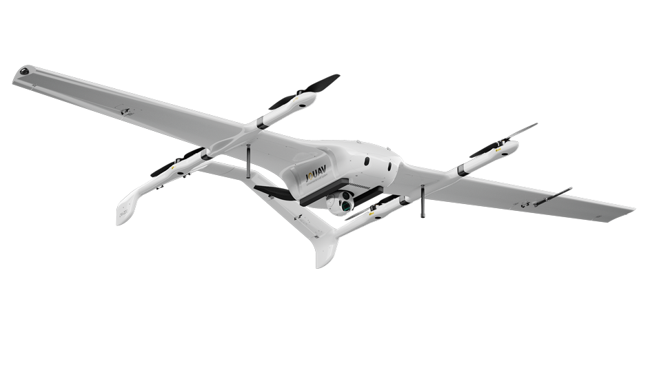
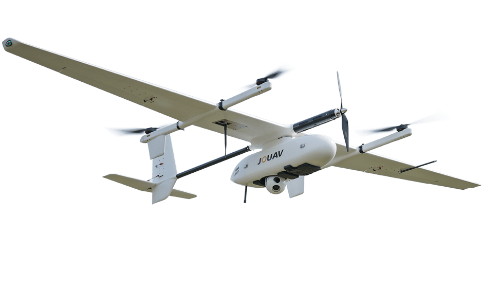
VTOL platform under program
Electric long-endurance VTOL drone. Large payload capacity, extended endurance, and AI-assisted mission planning for industrial mapping at scale.
Learn More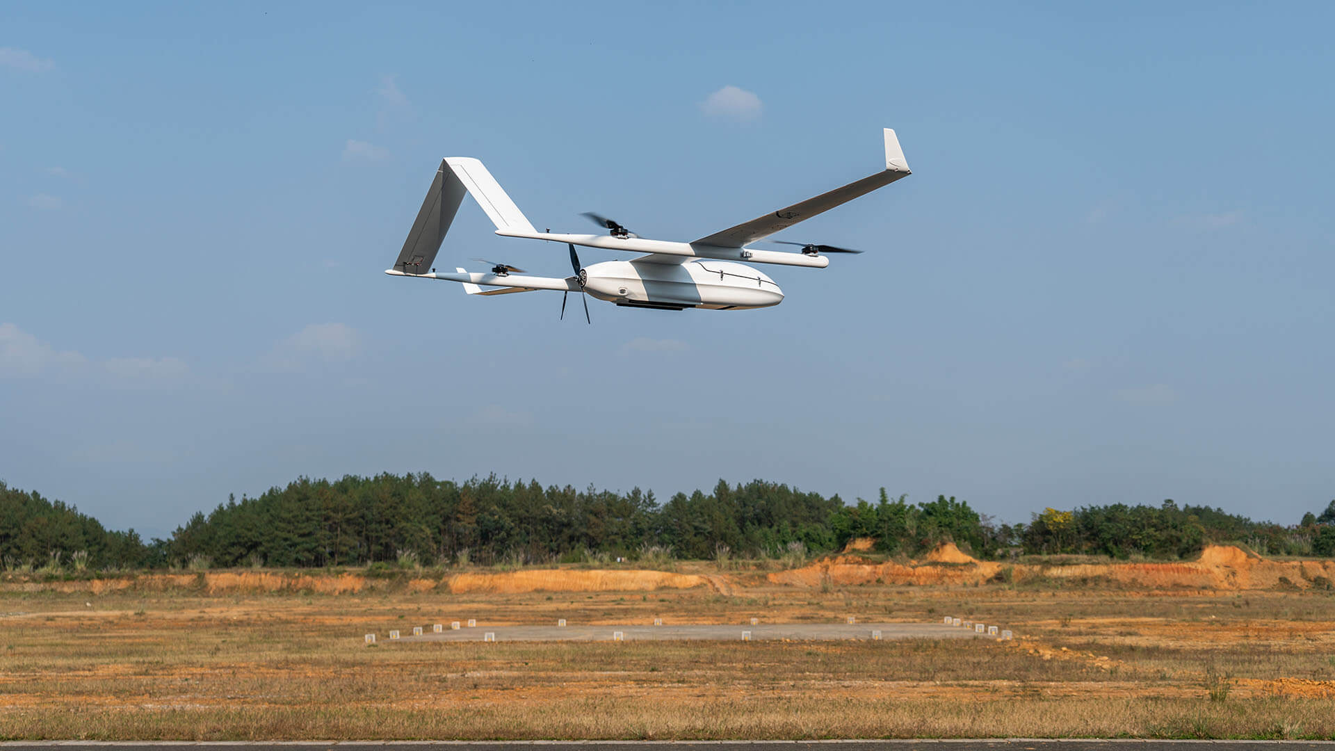
VTOL platform under program
Electric fixed-wing VTOL with 150–210 min endurance — reference platform for Andean mining volumetrics and LiDAR sorties above 5,000 m.
Learn More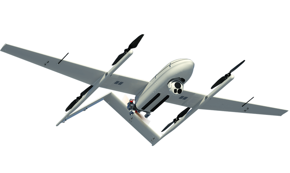
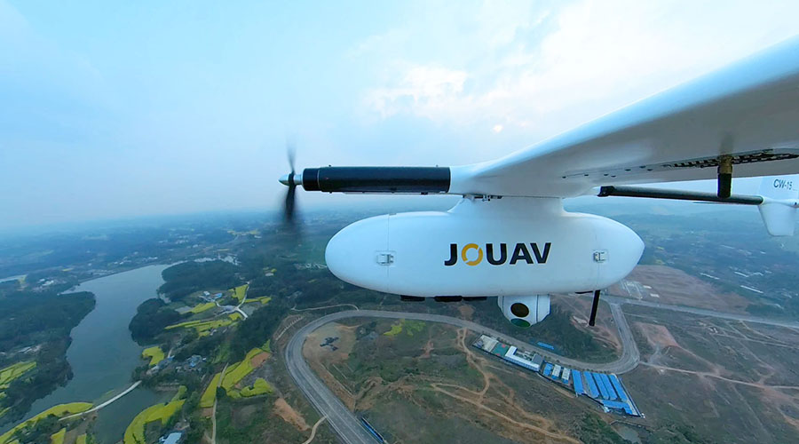
VTOL platform under program
Hybrid gasoline & battery long-endurance VTOL. Built for land and coastal missions — high altitude, heavy payloads, and port-infrastructure oversight.
Learn MoreSurvey-grade EO and LiDAR — modular on program VTOL sorties, never sold as standalone consumer cameras.
DAI-UAV payload
61 MP full-frame mapping camera for orthophotos, DSMs, and 3D models — shock-isolated for VTOL sorties above 5,000 m.
Learn More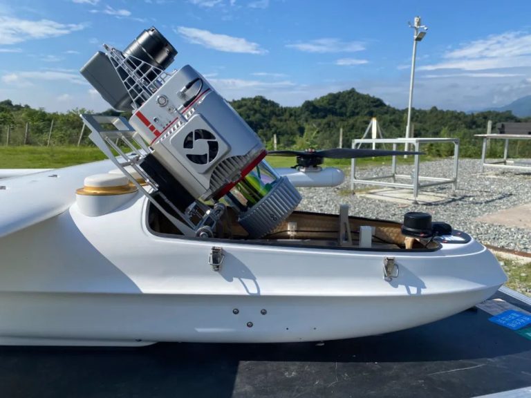
DAI-UAV payload
JoLiDAR-120G long-range scanner — 16-return canopy penetration, GCP-free point clouds for pits, corridors, and grids.
Learn MoreDAI-FlightSurv for survey planning and DAI-Eagle for surveillance — mission design, live ISR, and DAI-ATLAS publishing from one institutional stack.
DAI software
Survey and mapping mission planner — AOI design, RTK/PPK workflows, and orthophoto export to DAI-ATLAS.
Learn More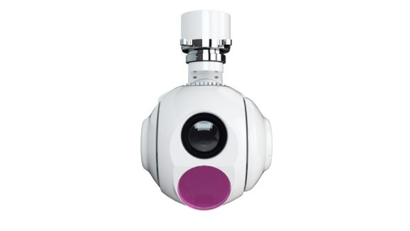
DAI software
Surveillance and ISR console — EO/IR gimbal control, auto-track, and live video fused into DAI-ATLAS.
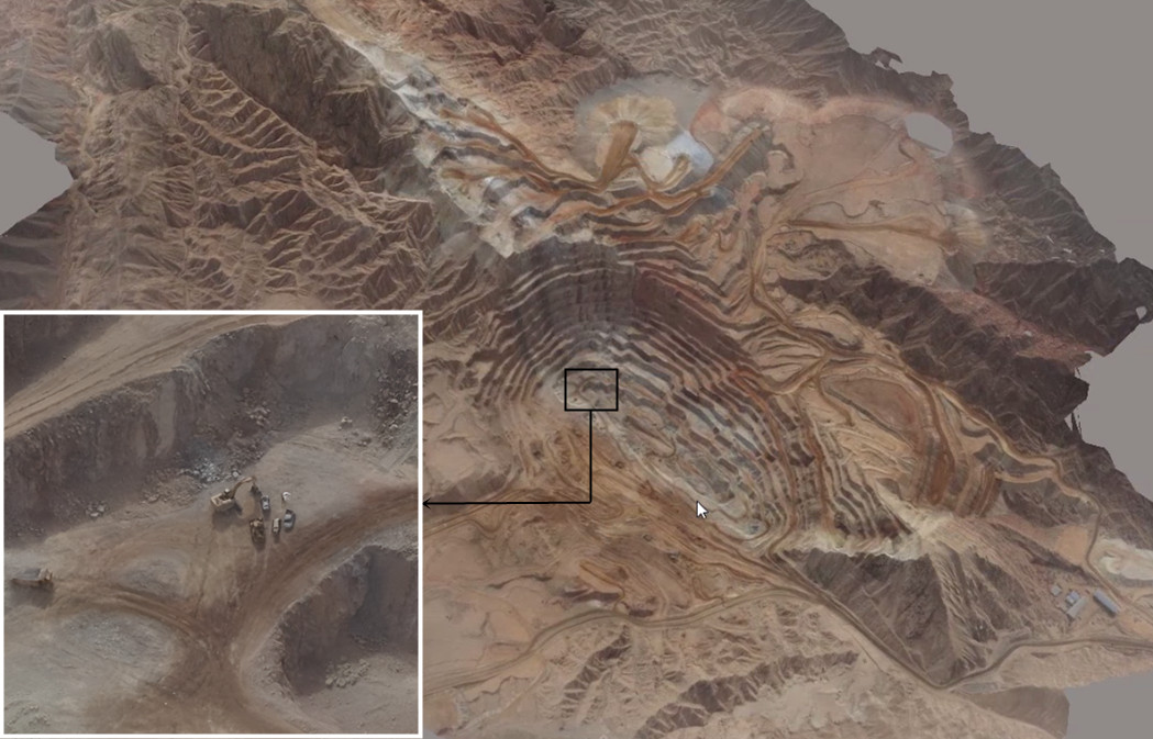
Learn MoreSatellite Andes baseline plus VTOL DAI-UAV field collection — hover each sector to see field video. DAI-ATLAS calculates outputs for agriculture, mining, security, and energy.
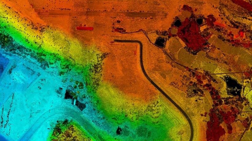
Orbital baselines fused with RTK orthophotos, oblique imagery, and LiDAR — large-scale mapping across the Peruvian Andes with survey-grade deliverables in 24 hours.
Learn MoreDAI deploys VTOL missions across Latin America — increasing efficiency and reducing risk for sovereign and enterprise programs.
“Integrated VTOL programs above 5,000 meters in the Andes. DAI field support and DAI-ATLAS fusion are unlike anything we have seen from commercial UAS providers in Latam.”


The latest from Derteano Aerospace Intelligence — product releases, field deployments, and major events.
LIMA, Peru – As transmission lines traverse the Andes, canyons, and geologically complex corridors, DAI deploys continuous SAR-backed geohazard intelligence for critical infrastructure.
LIMA, June 2026 – DAI welcomed regional government and mining operators to the Derteano Tech Park for an enterprise study tour focused on sovereign UAS manufacturing.
LIMA, March 2026 – Derteano Aerospace Intelligence expands OEM UAV integration, spare-parts coordination, and 24-hour DAI-ATLAS mission desk coverage.