from USD 4,900/mo
Desk Perú
Satellite + SENAMHI/MTC + reports + Intelligence Mesh. No hardware in contract.
First report in 14 days
Request institutional demo
Peru · orbital era · institutional
DAI-ATLAS · SpaceX · Grok · Cursor · Peru 2026As Peru advances its strategic alliance with the United States and northern launch infrastructure, DAI connects orbital momentum to the field: LEO uplink gate, VTOL sync, and sovereign DAI-ATLAS delivery for mining, agro, and defense-grade programs.
Pilot target: first institutional baseline in 90 days
LEO field uplink · LiDAR & orthophoto sync · pit volumes & NDVI · sovereign DAI-ATLAS API.
Mining · agro · petro · water · MINDEF-grade programs
Three commercial SKUs aligned with the Peru Program — from intelligence-only desk to full OEM co-delivery.
from USD 4,900/mo
Satellite + SENAMHI/MTC + reports + Intelligence Mesh. No hardware in contract.
First report in 14 days
Request institutional demoUSD 22,000
Single AOI, cited report, 90-day scenario. Due diligence ready.
Delivery in 21 days
Request institutional demofrom USD 95,000
50% on signing → active intelligence months 1–4 → 50% before OEM UAV shipment (3–5 months).
Intelligence from day 1
Request institutional demoVTOL and sensors sync only when DAI clears the uplink. Atlas Vision interprets frames. DAI-ATLAS publishes institutional outputs.
 01
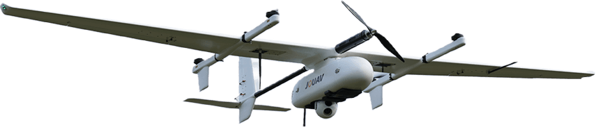
01VTOL · LiDAR · IoT at 5,000 m
 02
02DAI-LINK health · sync clearance
 03
03Entities · tasks · objects API
 04
04Pit volumes · NDVI · change detection
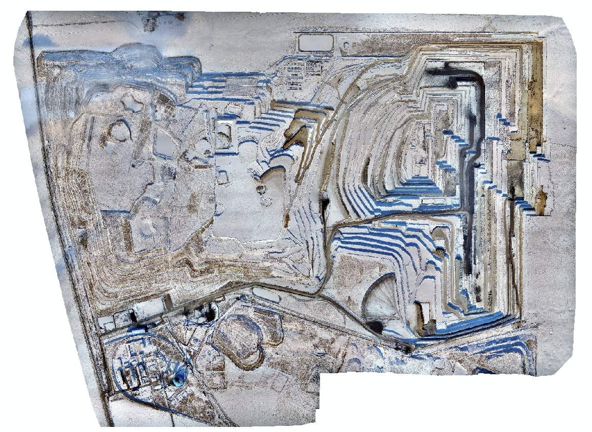
Real Andes baseline outputs — orthophoto, pit analysis, and NDVI corridors — the same deliverables Program clients receive.
Atlas Vision outputs
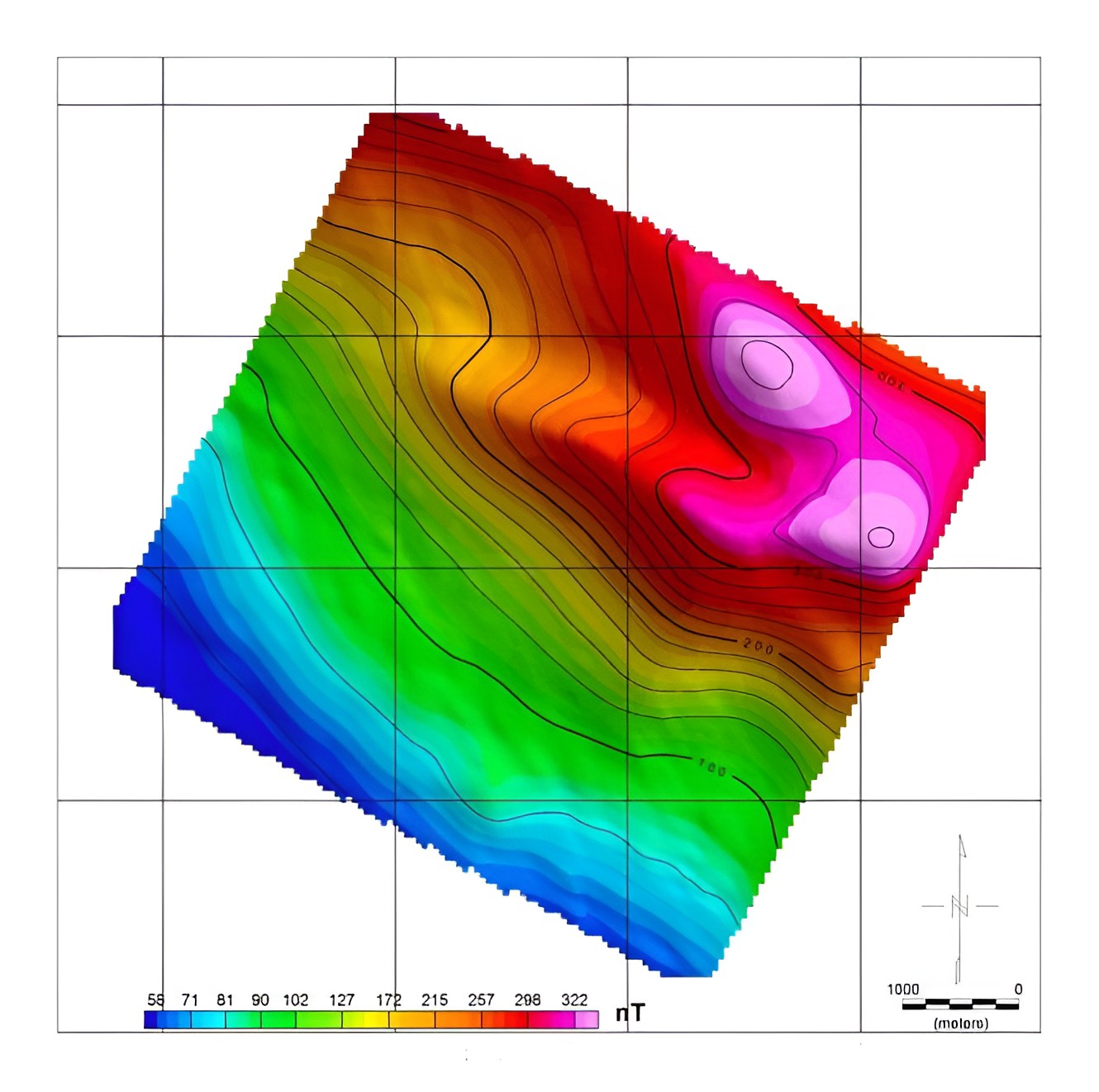
Orthophoto · pit volumes · NDVI stress corridors
Hover or tap to play field video

SpaceX LEO uplink
Edge agent on camp LAN monitors Starlink health. DAI clears or holds LiDAR and orthophoto sync before publish — mining, agro, petro, water across remote Andes.
mining · agro · petro · water
Field agent · Peru pilot sitesDemo preview
Numbers shown in commercial previews use simulated data. Deploy a DAI edge agent on your LAN to see real obstruction, downlink, and sync clearance for your operation.
Live metrics require a deployed edge agent on your site
Optional live globe for pass planning and connectivity context — opens in a dedicated tracker (external).
Ground agents and orbital context together explain when critical survey sync is cleared or held — before LiDAR and orthophoto upload.
Orbital reference satellitemap.space
TLE source satellitemap.space · Space-Track.org · CelesTrak · JPL Horizons