CAPABILITIES · DAI-ATLAS
Any sensor. One screen. Peru first.
You do not need ten different apps for ten different brands. DAI-ATLAS is the control room that connects drones, towers, cameras, and alerts — and shows your team what matters on a live map.
What we specialize in
Six areas — explained without jargon.
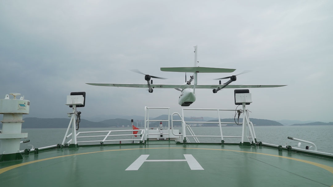
Drones & robots
Flying and ground units — from small recon drones to long-range VTOL and field robots.
Learn more →Watch & detect
Day and night cameras, thermal video, and automatic alerts when something changes on your asset.
Learn more →Full-site protection
Fixed towers, mobile kits, and perimeter sensors — one command screen for plants, ports and corridors.
Learn more →Industrial risk
Environmental, hydrological and operational anomalies — structured alerts for mines, energy and cities.
Learn more →Cameras & sensors
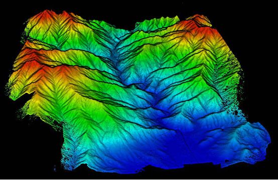
Gimbals, LiDAR, and survey payloads on authorized VTOL platforms — data flows straight to Atlas.
Learn more →Real missions
Border, coast, mines, cities, and emergencies — the same stack, different playbook.
Learn more →Missions we support
Pick your scenario — DAI-ATLAS adapts.
Remote & Amazon corridors
Persistent geospatial watch across jungle and highland corridors — satellite baseline plus field sensors.
Coast & ports
Ships, docks, and offshore assets — fused alerts for navy, port authority, and operators.
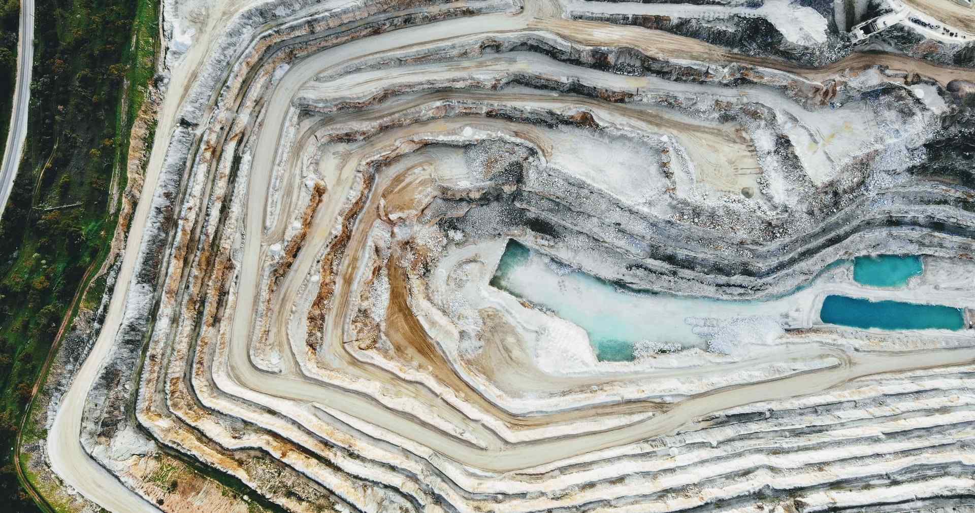
Critical infrastructure
Dams, pipelines, power lines, and mining pits — change detection before failure.

Cities & municipalities
Traffic, parking, environmental heat, and civil SAR — structured alerts, not endless video.
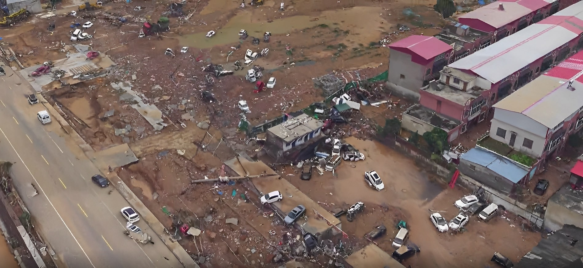
Disasters & emergencies
Fast aerial view after floods, slides, or fires — shared map for civil defense and institutions.
Defense & institutional
B2G programs, counter-intrusion, and allied equipment under contract — separate secure channel.
Choose your mission
One brain, many desks. Pick your sector and see the dashboard, the required payload and integrations — and the decision it enables.
Protect yield before stress becomes loss.
0.78Crop vigor (NDVI)+4% vs last pass
6Water stress zonesSector NE rising
94%Yield forecastOn target
Payload
MultispectralThermalRGB
Integrations
Sentinel-2 / PeruSAT historyVTOL mapping flightsWeather + soil probesAgro ERP / irrigation
How DAI-ATLAS works — in four steps
Think of it as the brain behind your hardware. The equipment sees; Atlas understands and remembers.
1 · Connect
Your drones, cameras, and sensors send location, video, or alerts — even from different manufacturers.
2 · See on one map
Every asset and every track appears on a live territorial map — plus satellite and weather context.
3 · Assign missions
Patrol this corridor, watch this gate, scan after the storm — your desk sends clear tasks to the field.
4 · Decide with proof
Alerts, reports, and video clips are stored with time, place, and legal basis for institutional review.

What teams actually do with it
Respond faster
Deploy drones or activate sensors in minutes — everyone sees the same picture on Atlas.
See product →
Keep people out of danger
Let robots and remote sensors inspect risky sites — operators stay in the command room.
See product →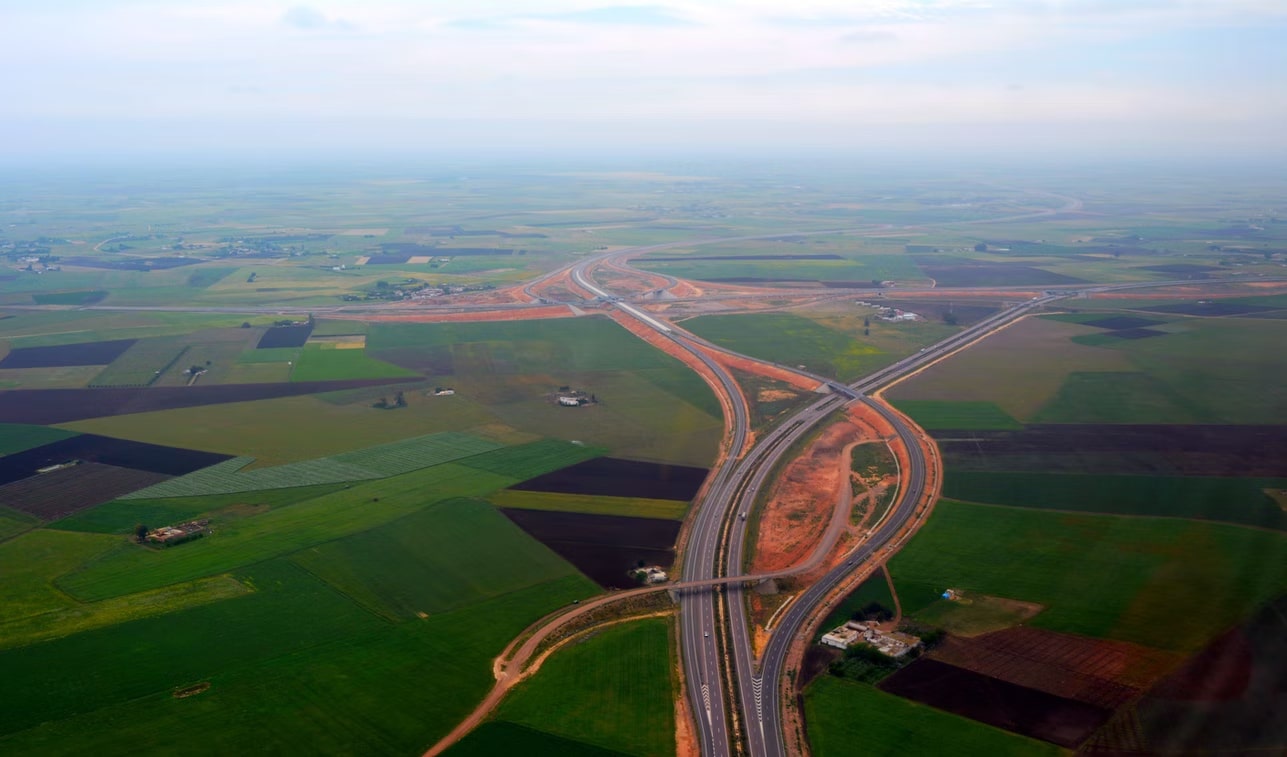
Reach hard places
Fly supplies or relay communications where roads fail — Andes, Amazon, or offshore.
See product →
Inspect infrastructure
Bridges, lines, pits, and coastlines — compare today vs last month automatically.
See product →Featured capabilities
Built for programs — not gadget shopping.

Many small eyes, one brain
Swarm intelligence
Mini drones in a mesh report structured alerts — traffic, heat, search-and-rescue — without flooding your network with video.
Explore →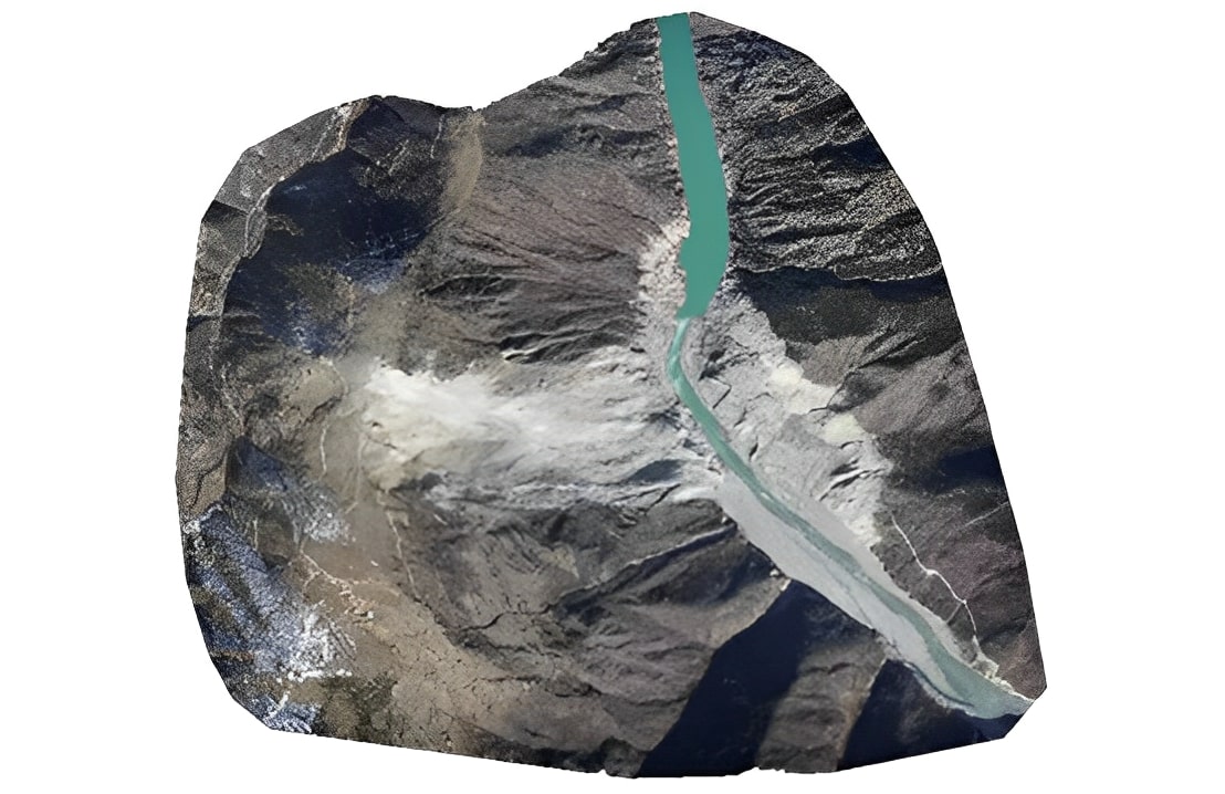
Your brand + our brand + legacy
Mixed-fleet desk
Atlas ingests telemetry from authorized OEM platforms and allied gear into one track store.
Explore →See what moved — week by week
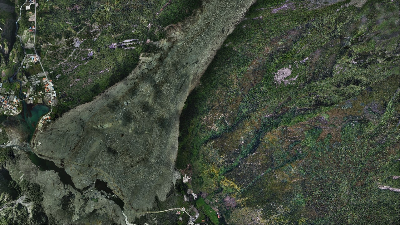
Territorial change detection
Satellite revisit plus field sensors flag illegal mining, deforestation and infrastructure drift before complaints arrive.
Explore →The future of operational success
Any territory.One sovereign desk.
Derteano DAI delivers geospatial + AI for Peru and LATAM — mining, energy, agriculture, cities and institutions. Defense programs available on a separate institutional channel (~10%).
Let's connect — tell us your mission.