1. Overview — the problem it solves
Mining teams, civil defense, infrastructure concessionaires, and border operators receive data in silos: headlines in one tab, satellite imagery in another, IoT telemetry on a separate console, digital OSINT in spreadsheets. Nothing correlates across the same AOI with audit trail.
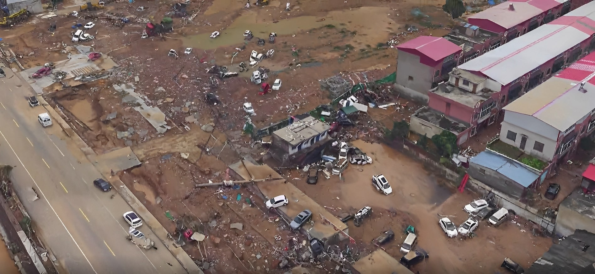
DAI-ATLAS unifies those sources under an institutional tenant. Each run produces a territorial probability score — tailings risk, infrastructure stress, geopolitical escalation, thermal anomaly — and a brief stating who confirms in field, what to inspect, and which assets to deploy (VTOL, mesh relay, satellite window).
2. Data layers — five parallel nodes
After the GDELT seed, four observation nodes run simultaneously. They do not wait on each other: satellite does not block drone; Flowsint does not depend on SENAMHI finishing.
- GDELT / D-Sentinel — verified headlines, thematic beats, time-stamped geopolitical context.
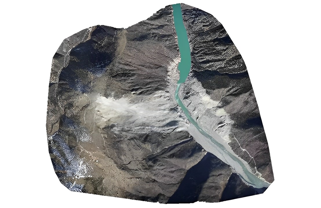
- Satellite — PeruSAT + Sentinel: NDVI, cover change, cloud cover, ORBIT BRIDGE windows.
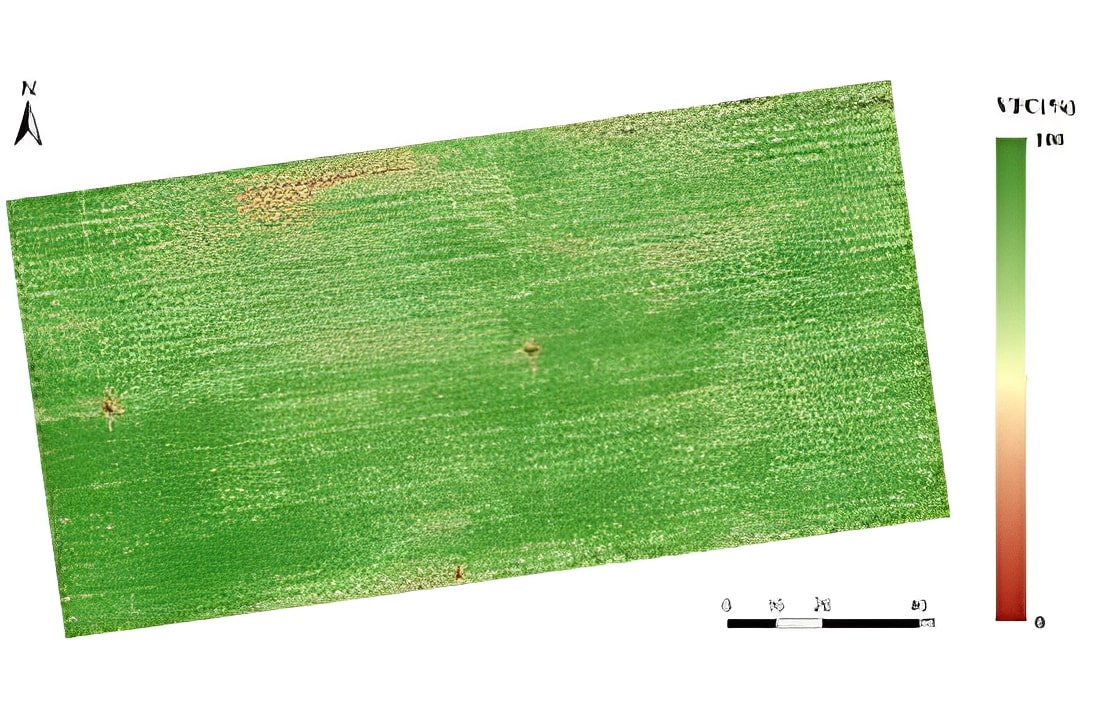
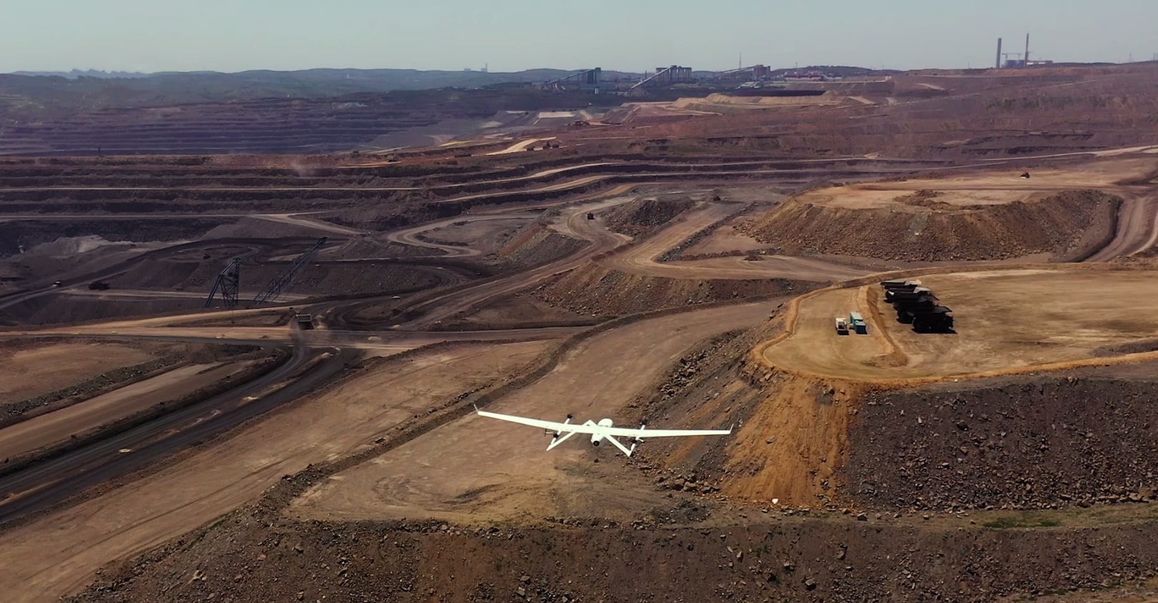
- DAI-UAV / VTOL — RTK orthophoto, LiDAR, thermal when OEM layer is in program (CW-15 / CW-25E).
- Terrestrial sensors — SENAMHI, USGS seismic, mesh gateways, field IoT.
- Flowsint — Neo4j graph of domains, orgs, IPs, emails; WHOIS, DNS, org→ASN enrichers.
3. Five-step pipeline — ingest to decision
Step 1 — GDELT ingest: D-Sentinel validates headlines and seeds the base scenario with keywords and seed sources.
Step 2 — Parallel observation: each node emits telemetry, metrics, and alerts to the Atlas bus in no fixed order.
Step 3 — Territorial fusion: an agent mesh correlates cross-signals (e.g. GDELT headline + Flowsint subdomain + NDVI drop). The fusion engine does not compute market probability here — it computes multi-source territorial stress.
Step 4 — Atlas probability engine: aggregates per-node scores, applies institutional tenant weights, outputs one percentage with confidence interval.
Step 5 — Decision brief: auditable export with field recommendation, ORBIT BRIDGE 48 h SLA, and custody line.
4. Flowsint — the digital graph node
Flowsint runs as a local sidecar (Docker :5173) or institutional deploy. Enrichers chain OSINT queries on entities tied to the AOI: concession vendors, logistics domains, associated wallets.
The iframe on the Atlas desk shows the live graph; discovered nodes feed territorial fusion as additional signals, not a separate PDF export. Analysts can open the full workspace to pivot manually, but the institutional pipeline already ingested findings automatically.
5. Territorial fusion — multi-node engine
The fusion engine receives GDELT context plus readings from satellite, VTOL, sensors, and Flowsint entities. Agents simulate correlations and contradictions: if the headline mentions thermal anomaly but satellite shows no change, score drops; if precipitation sensors rise and NDVI falls, tailings score rises.
In production, the fusion sidecar writes rows to Supabase via webhook; the site only reads precomputed results (no visitor blocking). In demo, simulated activity shows the same visual rhythm as a live run.
6. Probability engine and audit
The fused score is not a simple average: each node has configurable weight by industry (mining prioritizes tailings; infrastructure prioritizes MTC + satellite). Atlas logs which sources participated, timestamps, and model version.
Every output includes auditLine — active node count, live vs demo fusion, score version. This satisfies custody requirements for concessionaires and civil defense.
7. ORBIT BRIDGE — probability to action
When score exceeds institutional thresholds, Atlas generates an action list: schedule CW-25E sortie, request PeruSAT window, activate mesh relay in dense canopy, escalate to command room.
ORBIT BRIDGE is the 48-hour commercial SLA from signing: satellite capacity + VTOL deploy + Atlas tenant integration. The intelligence desk you see here is the same logic operating in the client command center.
8. Operations — demo, sidecars, and production
Demo mode: simulated activity + sample fusion without sidecars. Hybrid: live GDELT from D-Sentinel cron + fusion panel from last Supabase simulation. Full: Flowsint :5173 + fusion sidecar :5174 + cron + webhooks.
- npm run flowsint:up — local digital graph.
- npm run mirofish:ready — multi-node fusion UI.
- Cron /api/public/cron/simulate — triggers fusion run from GDELT headline.
- Webhook simulation-result — persists verdict in Supabase for instant read.